Map of Nagano Prefecture in Japan with hiking trail marked in red, mountain and park icons, and nearby cities labeled.

About the Cities of Nagano

Nagano Prefecture is made up of a variety of cities and towns, each playing a role in the region’s culture, economy, and daily life. From historical centers and resort towns to rural farming communities, this section offers basic facts and overviews to help you better understand the area's local character.

For some cities—especially Nagano, Ueda, Matsumoto, Nozawa Onsen, Yamanouchi, and Iiyama—I’ve included personal insights and experiences based on my time there. I hope these notes help you get to know these places more deeply and personally.


Important Cities


Cityscape of Nagano City with a mix of modern and traditional buildings, against snow-capped mountains in the background.

Nagano City

Population: ~380,000

Area: 834 km²

The capital city of the region, famous for Zenkoji Temple.

Hosted the 1998 Winter Olympics.

Photo of Matsumoto Castle in Japan with a moat, green trees, city buildings, and mountains in the background under a partly cloudy sky.

Matsumoto

Population: ~240,000

Area: 978 km²

Known for the historic Matsumoto Castle.

A cultural and art center, gateway to Kamikochi.

A cityscape of Ueda, Japan, with traditional Japanese castles in the foreground and modern buildings with mountains in the background.

Ueda

Population: ~160,000

Area: 300 km²

Famous for Ueda Castle and samurai history.

Known for traditional festivals.
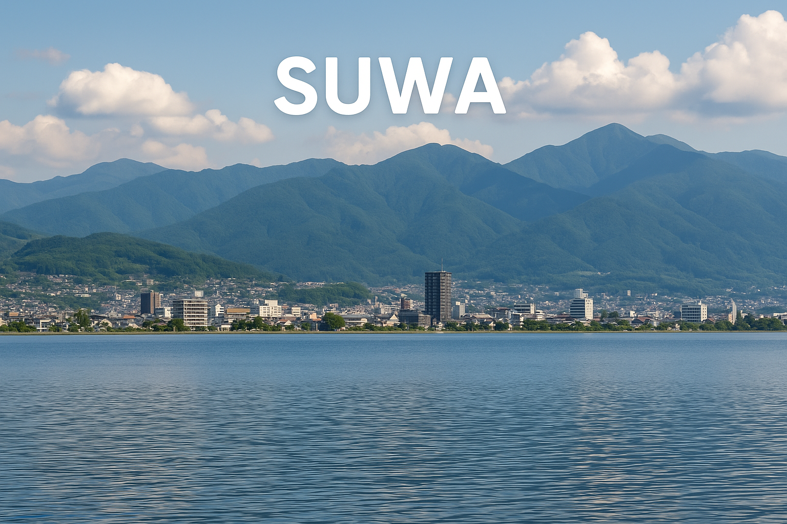
A cityscape with buildings along a shoreline, surrounded by green mountains under a partly cloudy sky, with the word 'SUWA' overlayed at the top.

Suwa

Population: ~50,000

Area: 193 km²

Located around Lake Suwa.

Famous for its hot springs (onsen) and Suwa Shrine.

A traditional wooden building in the foreground surrounded by lush green trees, overlooking a town with many rooftops, snow-capped mountains in the background, and clear blue sky. The text 'Iiyama City' is overlaid at the top.

Shiojiri

Population: ~70,000

Area: 323 km²

Known for wine production.

An important stop on the historic Nakasendo Road.

A city street scene with buildings on both sides, electrical poles and wires overhead, a mountain in the background, and a clear blue sky. The words 'NAKANO CITY' are overlaid at the top.
A street view in Komoro City with traditional Japanese houses and a mountain with snow in the background, under a clear blue sky.

Iiyama

Population: ~21,000

Area: 304 km²

Popular for winter sports.

Close to Togakushi and sacred mountains.

Three bicycles parked in front of a pond with houses and mountains in the background, under a clear blue sky with a few clouds.

Komoro

Population: ~43,000

Area: 86 km²

Known for Komoro Castle and natural hot springs.

A cityscape with houses and buildings in the foreground, and snow-capped mountains in the background under a clear blue sky, with the letters 'INA' overlaid at the top.

Chino

Population: ~54,000

Area: 198 km²

Famous for the Yatsugatake Mountains and hot springs.

Scenic view of a river with small waterfalls, surrounded by green mountains and residential buildings, with the word 'YAMANOUCHI' overlaid.
A street scene with autumn trees with orange and red leaves lining the sidewalk, a modern glass building, a parked car, utility poles with power lines, and a partly cloudy sky.

Yamanouchi

Population: ~14,000

Area: 240 km²

Home to the Snow Monkey Park (Jigokudani Yaen-koen).

Famous for Shiga Kogen ski area and many hot springs.

Traditional Japanese wooden building on a hillside with a narrow street, surrounded by green mountains and other residential buildings.

Karuizawa

Population: ~20,000

Area: 104 km²

A popular resort town known for shopping and outdoor activities.

Offers cool summers and skiing in winter.

A quiet street in Tsumago, Japan, lined with traditional wooden buildings, with mountains and snow-capped peaks in the background.

Nozawa Onsen

Population: ~3,000

Area: 35 km²

A historic hot spring village and ski resort.

Famous for its traditional public baths and festivals.

Ina

Population: ~68,000

Area: 195 km²

An agricultural and cultural center.

Known for historic temples and festivals.

Nakano

Population: ~42,000

Area: 195 km²

Known for agriculture and handicrafts.

Ideal for hiking and outdoor activities.

Tsumago (Kiso)

Population: ~300 (in the post town area)

Area: Part of the larger Kiso district (~600 km²)

A beautifully preserved Edo-period post town along the old Nakasendo route.

A split-screen image showing modern city life on the left with tall buildings and a busy street, and traditional Japanese town with wooden houses and narrow street on the right. The word "SHOJI" is overlaid in the center.
A scenic landscape of green fields and houses with mountains in the background, under a partly cloudy sky, with the word 'SAKU' overlaid in the center.

Saku

Population: ~100,000

Area: 395 km²

An inland city balancing industry, agriculture, and access to the highlands.